欢迎来到IKCEST
Search
高级搜索
Navigation
Home
文件
Post
报告
电子报
数据
地震主题数据库
干旱主题数据库
洪水主题数据库
冻结受试者数据库
热浪主题数据库
野火主题数据库
生态与环境学科数据库
城市学科数据库
社交媒体挖掘主题数据库
飓风灾难主题数据库
一带一路区域基础数据库
“一带一路”区域灾害数据库
中蒙俄经济走廊区域数据库
巴基斯坦经济走廊区域数据库
孟中印缅经济走廊区域数据库
地图
中国历史灾难
生物灾害
地质灾害
地震灾害
气象灾害
洪涝灾害
栅格数据
向量数据
教育
地理信息系统的收件箱
灾难知识
呈现
培训视频
参考报告
灾难新闻视频
科普
国际培训
主题目录
组织
专家
网站
应用
信息聚合
使用Web地理信息系统的应用
科学数据可视化
自然科学研究工作
紧急救灾服务
目录
Scholar
ALL
地震
洪水
干旱
地质灾害
森林火灾
海啸
极端热浪
台风
灾害预警
减少灾害风险
川藏铁路
Emergency Disaster Mitigation Services
首页
Literature Categories
Atmospheric Environment
More
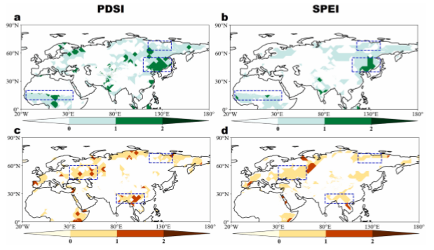
Concurrent trend turnings of drought severity across Afro-Eurasian continent since 1950
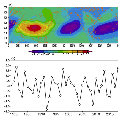
Links between the thermal condition of the Tibetan Plateau in summer andatmospheric circulation and climate anomalies over the Eurasian continent
Livestock
More
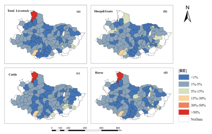
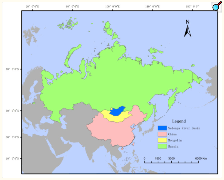
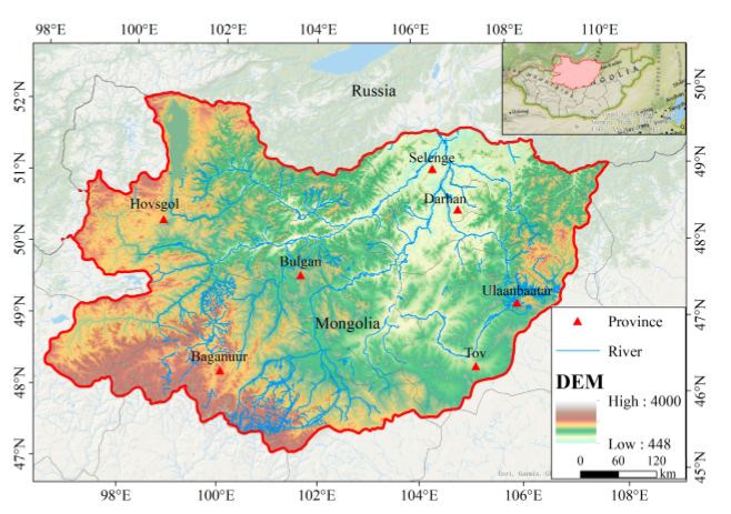
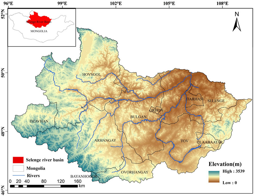
Mapping livestock density distribution in the Selenge River Basin of Mongolia using random forest
Agriculture
More
Deep learning empowers the Google Earth Engine for automated water extraction in the Lake Baikal Basin
Applicability of Grassland Production Estimation Using Remote Sensing for the Mongolian Plateau by Comparing Typical Regions in China and Mongolia
Spatial-Temporal Pattern Analysis of Grassland Yield in Mongolian Plateau Based on Artificial Neural Network
Groundwater use in the Selenge River Basin, Mongolia
Earth Sciences
More
Detrital zircon U-Pb dating of Late Mesozoic strata in the Junggar Basin, NW China: Implications for the timing of collision between the Karakoram-Lhasa Block and the Eurasian continent
Spatiotemporal variability of snow cover timing and duration over the Eurasian continent during 1966–2012
Social Economic
More
Spatial-temporal heterogeneity of sustainable development goals and theirinteractions and linkages in the Eurasian continent
Geography
More
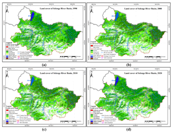
Some correlations between the river regime and land cover changes caused by climate change in the Selenge River Basin, Mongolia
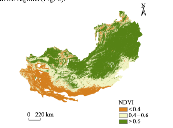
Vegetation Changes from 2014 to 2023 in the Mongolian Plateau Permafrost Region under Climate Change
Analysis of Land Use/Cover Change and Driving Forces in the Selenga River Basin
Landscape Ecological Risk Assessment and Analysis of Influencing Factors in Selenga River Basin
Environmental Sciences
More
Dynamic evolution of spring sand and dust storms and cross-border response in Mongolian plateau from 2000 to 2021
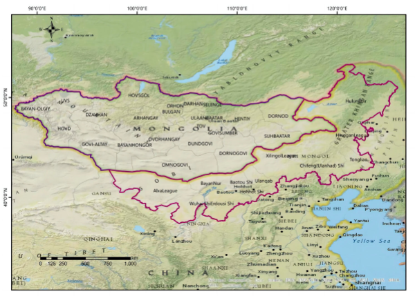
Spatiotemporal evolution and driving mechanisms of desertification on the Mongolian Plateau
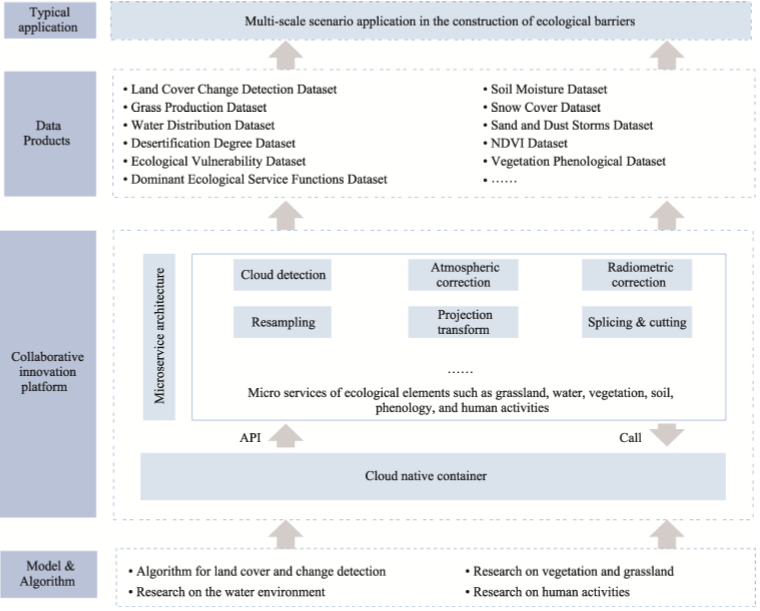
Issues, Progress, and Recommendations in the Construction of Ecological Barrier on the Mongolian Plateau from the Perspective of Big Data
Spatial-temporal pattern of desertification in the Selenge River Basin of Mongolia from 1990 to 2020
数据列表
|
关于
|
联系我们
|
如何使用
ICP备案号:京ICP备14021735号-1
© 2008 - 2022 IKCEST All rights reserved